Through our partnership with Locomizer researchers can now access a collection of footfall and destination flow data to improve understanding of how residents, workers and transient populations move around our towns and cities.
Each dataset is built using mobile trace data generated by a representative panel of anonymous users, and provides insight into footfall, mobility patterns and destination flows across 125 UK cities and towns.
“Places are complex systems shaped by how people move, gather and spend time within them. Adding Locomizer data to HASP gives researchers a new way of exploring these dynamics at different scales and times of day across the year.
As always, our priority is to ensure this kind of data is accessed responsibly and used to generate insights that support healthier, more equitable and more sustainable communities.”
Professor Nik Lomax, Director of the Healthy and Sustainable Places Data Service
The Locomizer data will support research in areas such as urban planning, retail analytics, transport modelling, and environmental and health impact assessment.
Locomizer Daily Destination Data
This dataset provides origin–destination flows at H3 spatial resolution – level 10 origins (approx. 66m radius) to level 11 destinations (approx. 25m radius) – available for 125 UK cities and towns for each day of 2025.
Metrics include:
- Extrapolated users travelling between two areas
- Extrapolated mobile signals along those flows
- Separate datasets for all travel, pedestrian travel, and non-pedestrian travel
This enables robust analysis of daily mobility patterns, without identifying individual trip start or end points.
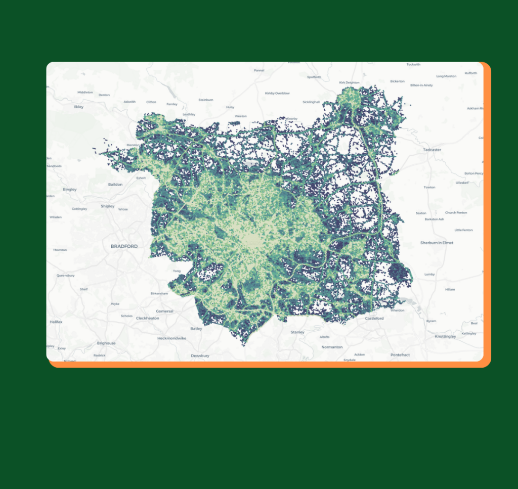
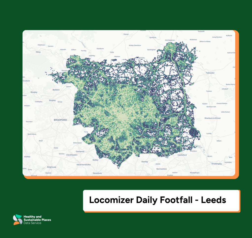
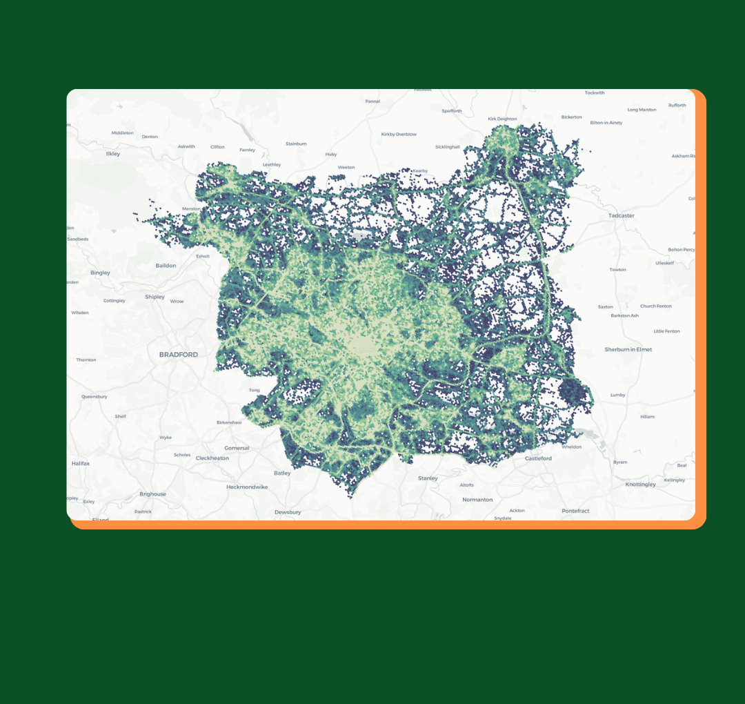
Locomizer Daily Footfall
This dataset provides daily footfall metrics at H3 spatial resolution, level 11 (approx. 25m radius) – available for 125 UK cities and towns for each day of 2025
Metrics include:
- Observed and extrapolated users
- Signal counts
- Pedestrian vs non-pedestrian modes
- Average dwell-time scores
This dataset enables researchers to explore daily popularity and usage patterns in specific areas.
Locomizer Hourly Footfall
At a finer temporal scale, this dataset provides hourly footfall metrics at H3 level 10 (approx. 66m radius), available for 125 UK cities and towns for each day of 2025
Metrics include:
- Observed and extrapolated users and signals
- Pedestrian vs non-pedestrian mode
- Visit type (resident / worker / transient)
- Reach, dwell time and footfall scores
This dataset supports highly granular time of day analysis for demand modelling, service planning, and behavioural insights.
Extensive Geographic Coverage
Locomizer trace data is now available for a wide range of UK locations, including major cities such as London, Manchester, Birmingham, Glasgow, Leeds, Cardiff, Edinburgh, and many others, as well as numerous towns and smaller urban centres.
About Locomizer
Locomizer is a provider of spatial analytics that use anonymised mobile trace data to generate insights into patterns of movement and activity across urban environments. Their approach draws on research into multiagent systems to translate historic geosignals into indicators of how people interact with places, producing metrics such as footfall, dwell time, reach, and inferred interest profiles.
Unlike methods that rely solely on counting visits or highly precise location data, Locomizer’s modelling focuses on the broader spatial context in which movement occurs, enabling analysis even where positional accuracy varies. This makes the datasets suitable for applications in urban planning, mobility research, retail analysis, and the study of behavioural patterns at different spatial and temporal scales.
Accessing the Data
All Locomizer datasets are now available to researchers by application through the HASP Data Catalogue.
Researchers interested in exploring footfall, mobility dynamics, or spatial behaviour patterns can apply for access, with support available from the HASP team for project scoping and responsible data use.


")