What is the PPFI and Index of Multiple Deprivation Explorer?
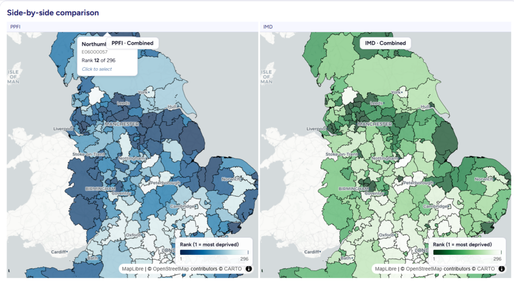
The PPFI and IMD Explorer is an interactive tool that brings together the Index of Multiple Deprivation and the Priority Places for Food Index to help users compare different dimensions of need across England. The tool highlights where general deprivation and food-related vulnerability align and where they do not, revealing important differences between neighbourhoods that may otherwise appear similar.
By combining these two perspectives, the tool highlights how food access challenges can exist independently of broader deprivation, offering a more complete and nuanced understanding of local conditions.
How to use the PPFI and IMD Explorer
• Explore interactive maps at neighbourhood and local authority level to view patterns of deprivation and food vulnerability
• Compare the IMD and PPFI side by side to identify where rankings differ
• Use the “differences explorer” to highlight and investigate areas of divergence
• Click on areas for more detailed local insights
• Filter and export data to support further analysis and decision-making
How to access the PPFI and IMD Explorer
User examples
“To improve public health, we have to understand the real-world barriers that stop people from accessing healthy, affordable food. The IMD and PPFI Explorer is a game-changer because it takes complex data and turns it into a practical tool for the food industry and policymakers. By building this robust evidence base, we can target support more effectively and drive the large-scale shift toward healthy and sustainable diets that we all want to see.”
“This tool helps us see that relying on a single measure of deprivation can miss important pockets of need. By comparing indices, we can better understand local variation and ensure interventions are reaching the communities that need them most.”
Hannah Skeggs, Senior Health and Sustainable Diets Manager, IGD