Our data can be used to support teaching across different educational levels, from engaging secondary school students in understanding the carbon impact of food to supplementing teaching resources for urban planning master’s programmes.
Data and tools from HASP have been applied by educators in different teaching contexts, enabling students to engage with evidence to understand place-based issues such as access to healthy food, how people move between geographies, and economic inclusion.
GCSE
Schools have used the Planet Plates game to teach GCSE-level students about the carbon footprint of different meals. Planet Plates is a fun interactive game, teaching students which meals are low carbon and how different foods have different carbon impacts from every step of the production cycle.
A-Level
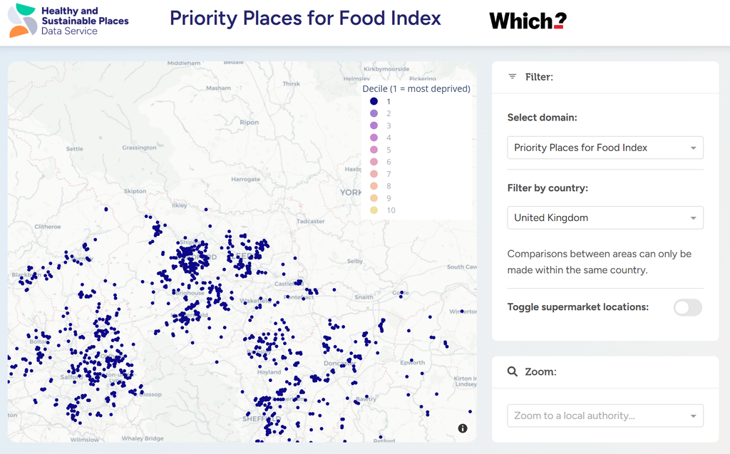
Both the Priority Places for Food Index (PPFI) and the E-Food Desert Index (EFDI) can be used in A-Level teaching about the food environment. The EFDI is a composite index mapping neighbourhood performance on key drivers of grocery accessibility, and has been used to support students to investigate food deserts.
PPFI has further introduced A-Level students to the accessibility of healthy and affordable food, as well as how to identify neighbourhoods most vulnerable to increases in the cost of living.
Undergraduate
Our data has been used in both coursework and dissertations by undergraduate students. The Spectus Origin-Destination mobility data is a dataset derived from mobile phone GPS signals providing daily indexed counts of journeys between and within local authorities, and has fed into student dissertations.
SIPHER Inclusive Economy is an index comprising of 13 economic inclusion indicators. This data has been drawn into work looking at topics such as monetary policy shocks, as well as providing socio-economic context to work exploring the food environment.
Postgraduate
Several of our datasets and tools have been integrated into teaching resources for modules within MSc programmes. Students engage with data from PPFI, EFDI, and the Mapping Advertising Assets Project when looking at real-world challenges in the food environment. The Nutrient Profile Model Calculator, developed by Dr Vicki Jenneson, is also used in nutrition policy education.
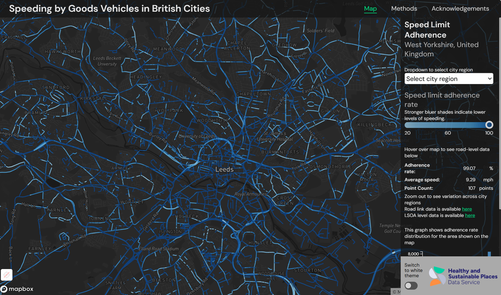
Our speeding dashboard is derived from GPS trajectory data sourced from Compass IoT, and measures speed adherence down to the road-link level across the UK. With this data helping to reveal the impact of road design and conditions on driver perceptions of speed limits, this dashboard can support teaching within urban planning and engineering programmes.
See our data catalogue and tools page to explore how our data can support teaching resources.